


A highly effective and rapid depression originating in southwestern Turkey affecting Lebanon and the eastern basin of the Mediterranean, accompanied by relatively cold air masses that lead to a noticeable drop in temperatures (between 8 and 10 degrees), heavy rain, active winds, and snow touching 1,500 metres. It subsides on Wednesday morning as the weather gradually stabilizes.
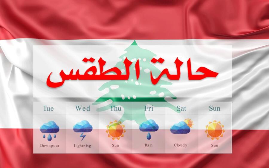
Note: Average temperatures for February in Beirut are between 11 and 19 degrees, in Tripoli between 9 and 18 degrees, and in Zahle between 3 and 13 degrees. Expected weather in Lebanon:
Tuesday: Cloudy with a noticeable drop in temperatures, which become below their seasonal averages. Thick fog forms on the highlands, worsening visibility, and scattered, heavy rain falls, especially in the period before noon, accompanied by thunderstorms. Therefore, we warn of the formation of torrents on the roads, especially in the northern regions, and the possibility of hailstones. Winds become active, reaching speeds of 70 km/h, causing sea waves to rise up to 3 metres. Snow falls at an altitude of 1,700 meters during the day and the level drops. It falls from the afternoon until it reaches 1400 metres. The intensity of the rain gradually decreases at night.
Wednesday: Partly cloudy to slightly cloudy, with rising temperatures and fog in the highlands. Drizzle falls sporadically during the morning, especially in the south of the country. The weather gradually improves during the day. We warn of ice forming on mountain roads above 1,500 meters during the night and dawn on Thursday.
Thursday: Partly cloudy to partly cloudy with high clouds and an additional rise in temperatures, especially in the mountains and inland.
Friday: Partly cloudy with high clouds, with no significant change in temperature, turning cloudy in the evening with moderate clouds, with fog on the highlands, and the weather is ready for drizzle.