


In welcome news for technology and travel enthusiasts, the “Tom’s Guide” website revealed a secret feature in the “Google Maps” application that is revolutionizing the way trips are planned and navigated in large cities.
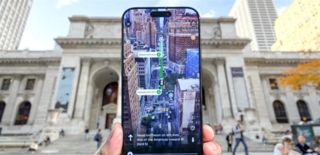
This feature, known as “Immersive View,” enables users to explore cities and roads in a three-dimensional manner that combines street view and aerial view, giving them a real picture of what they will encounter before reaching their destination.
Activating the feature:
The site explained that the user can activate this feature by clicking on the “Preview button” that appears after entering the destination in the application, so that the traditional route turns into an interactive display full of details and visual scenes, including cars, buildings and well-known landmarks.
A more convenient experience:
A live experience by “Tom’s Guide” of this feature showed that navigating New York City has become easier and more accurate, as the feature helped the user to identify roads and landmarks in advance, and helped reduce any unexpected surprises they may encounter upon arrival.
He says about this: “The feature has become the first thing I open in Google Maps when planning any new trip.”
A major obstacle:
Despite the great praise for this feature, it is still limited in spread, as it is currently available in only a few major global cities such as: Amsterdam, Barcelona, Dublin, Florence, Las Vegas, London, Los Angeles, Miami, New York, Paris, San Francisco, San Jose, Seattle, Tokyo and Venice.
Google is expected to gradually expand the scope of this feature in the coming period to include more countries and cities, in a move that will reflect its continued pursuit of integrating artificial intelligence and advanced imaging technologies into its popular application.