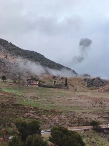


Lebanon and the eastern Mediterranean region are experiencing the impact of a low-pressure system coming from the Black Sea, accompanied by cold air masses. As a result, temperatures will witness a significant decrease, becoming lower than their normal rates for this time of year. Heavy rainfall is expected, accompanied by strong winds and thunderstorms, in addition to snowfall at an altitude of 1400 meters and above. The weather will be cold, and this impact will begin to gradually subside with the dawn of Tuesday. The region is expected to be affected again by another low-pressure system coming from northwestern Turkey starting at dawn on Wednesday, which will lead to the return of rain and snow until the afternoon of next Friday.
In this context, the head of the Surface Estimates Department at the Meteorological Department, Muhammad Kanj, explained in an interview that “today’s weather is witnessing a chance of rain with temperatures below average, and the highlands are witnessing thick fog, with the possibility of snowfall at an altitude of 1500 meters and above.”
Kanj added that “the weather will begin to improve in the afternoon with wide breaks, while the northern and southern regions remain prone to rainfall, and the wind speed today is about 60 km/hour, explaining that there is no storm as rumored, and talking about a wind speed of up to 110 km/hour is incorrect.”
As for tomorrow, Monday, he indicated that “the weather will be generally cloudy with a slight rise in temperatures, and the rain will return to fall from this evening. The rain is expected to be heavy during the afternoon, with amounts that may reach about 50 mm, and the wind speed will intensify in the northern regions to reach between 80 and 90 km/hour, while snow may fall at an altitude of 1200 to 1500 meters, but it will be light without significant accumulations, with the possibility of hail falling, as the impact of cold air masses gradually decreases during the night, with a warning of the formation of ice on mountain roads above 1200 meters.”
Regarding Tuesday, Kanj predicted “stable weather, partly cloudy to partly cloudy, with a slight rise in temperatures, while Wednesday’s weather will remain stable during the day, but accompanied by strong winds that may reach a speed of about 75 km/hour, especially in the northern regions during the morning and afternoon hours, with light rain beginning in the afternoon, and its intensity increasing from midnight until Thursday afternoon.”
Kanj pointed out that “the recorded rainfall amounts are positive, as the city of Tripoli witnessed about 30 mm, which raised the daily cumulative average from 130 mm to about 165 mm, which is a positive thing, and we expect during New Year’s Eve that the rainfall amounts will be greater than last year at this time, but we will remain below seasonal rates.”
He warned of “traveling on mountain roads during rainy weather, especially at an altitude of more than 1500 meters, due to the possibility of ice formation starting tonight until tomorrow afternoon, and also on Wednesday evening, and citizens should take precautions.”
It is worth noting that the thickness of the snow reached for the first time this year to about 15 centimeters at an altitude of 1250 meters above sea level, where it formed a layer that does not impede the passage of cars equipped with metal chains. Public Works Ministry bulldozers worked to open roads that rise more than 1500 meters, while all roads in the Bekaa region became passable for all cars, with the formation of pools of water on the roads as a result of heavy rain.
In this context, farmers in the Bekaa confirmed that “these rains feed the artesian wells that were threatened with drought, which is good news for the agricultural sector.”